Toggle navigation
Survey Subdivision Home
Viewers
Survey Subdivision GeoSearch
Survey Subdivision Text Search
Supporting data
Zip File Processing
Documentation
Survey Subdivision Tutorial
APIs
Survey Subdivision API
Search
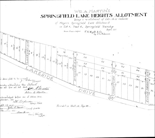
Plat: Springfield Lake Heights Allotment
Download Original
Identity of Document
Id:
994
Subdivision name:
Springfield Lake Heights Allotment
Document type:
Plat
Latitude:
41.0223992949305
Longitude:
-81.4403629302979
Dated on:
1912-09-26 19:00:00 -0500
Plat recorded in:
Book 14, pg. 38
Drawing Location:
Created at:
2009-06-30 07:01:27 -0400
Created by:
kelsey
 Download Original