Toggle navigation
Survey Subdivision Home
Viewers
Survey Subdivision GeoSearch
Survey Subdivision Text Search
Supporting data
Zip File Processing
Documentation
Survey Subdivision Tutorial
APIs
Survey Subdivision API
Search
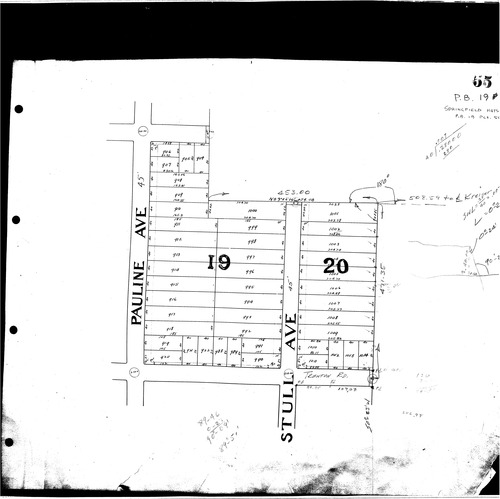
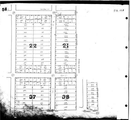
Plat: Springfield Heights Allotment
Download Original
Download Original
Identity of Document
Id:
989
Subdivision name:
Springfield Heights Allotment
Document type:
Plat
Latitude:
41.0468317637485
Longitude:
-81.4257287979126
Dated on:
2017-01-09 00:00:00 -0500
Plat recorded in:
Book 19, pgs. 55 - 56
Drawing Location:
Created at:
2009-06-22 10:48:49 -0400
Created by:
kelsey
 Download Original
 Download Original