Toggle navigation
Survey Subdivision Home
Viewers
Survey Subdivision GeoSearch
Survey Subdivision Text Search
Supporting data
Zip File Processing
Documentation
Survey Subdivision Tutorial
APIs
Survey Subdivision API
Search
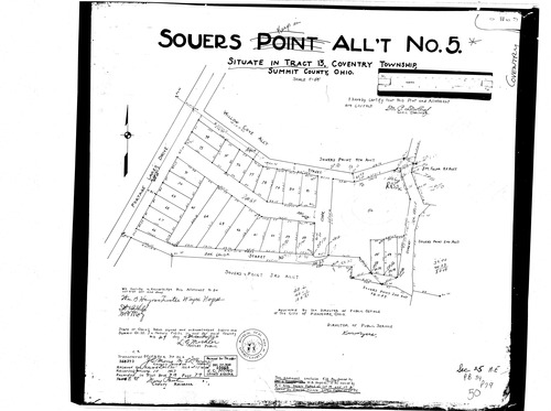
Plat: Souer's Point 5th Allotment
Download Original
Identity of Document
Id:
973
Subdivision name:
Souer's Point 5th Allotment
Document type:
Plat
Latitude:
40.9966054780751
Longitude:
-81.5339612960815
Dated on:
1927-01-09 19:00:00 -0500
Plat recorded in:
Book 34, pg. 79
Drawing Location:
Created at:
2009-06-29 09:16:29 -0400
Created by:
kelsey
 Download Original