Toggle navigation
Survey Subdivision Home
Viewers
Survey Subdivision GeoSearch
Survey Subdivision Text Search
Supporting data
Zip File Processing
Documentation
Survey Subdivision Tutorial
APIs
Survey Subdivision API
Search
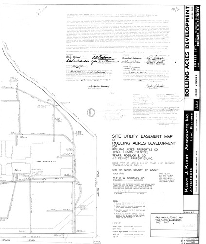
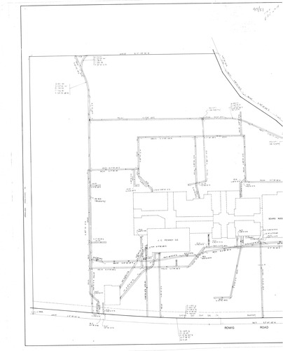
Plat: Rolling Acres Development Site Utility Easement Map
Download Original
Download Original
Identity of Document
Id:
882
Subdivision name:
Rolling Acres Development Site Utility Easement Map
Document type:
Plat
Latitude:
41.0501329718919
Longitude:
-81.5849876403809
Dated on:
1975-04-19 20:00:00 -0400
Plat recorded in:
Book 95, pgs. 50 - 51
Drawing Location:
Created at:
2009-06-29 11:14:58 -0400
Created by:
kelsey
 Download Original
 Download Original