Toggle navigation
Survey Subdivision Home
Viewers
Survey Subdivision GeoSearch
Survey Subdivision Text Search
Supporting data
Zip File Processing
Documentation
Survey Subdivision Tutorial
APIs
Survey Subdivision API
Search
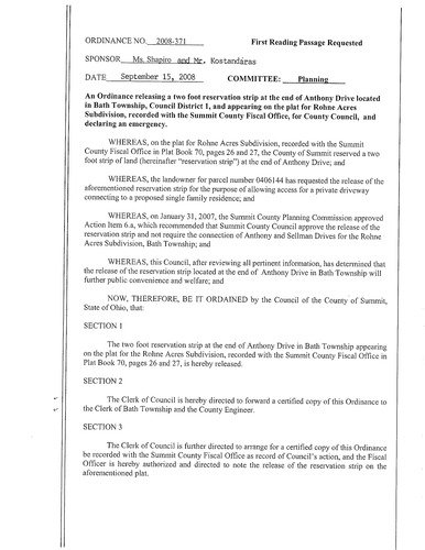
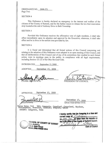
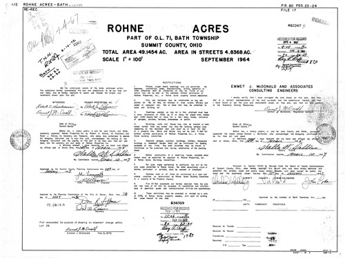
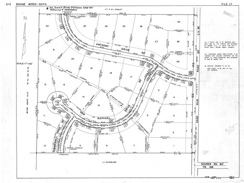
Plat: Rohne Acres
Download Original
Download Original
Download Original
Download Original
Identity of Document
Id:
881
Subdivision name:
Rohne Acres
Download All Pages
Document type:
Plat
Latitude:
41.151677356594
Longitude:
-81.589150428772
Dated on:
1967-04-05 19:00:00 -0500
Plat recorded in:
Book 80, pgs. 23 - 24
Drawing Location:
Created at:
2009-06-30 10:22:10 -0400
Created by:
zack
 Download Original
 Download Original
 Download Original
 Download Original