Toggle navigation
Survey Subdivision Home
Viewers
Survey Subdivision GeoSearch
Survey Subdivision Text Search
Supporting data
Zip File Processing
Documentation
Survey Subdivision Tutorial
APIs
Survey Subdivision API
Search
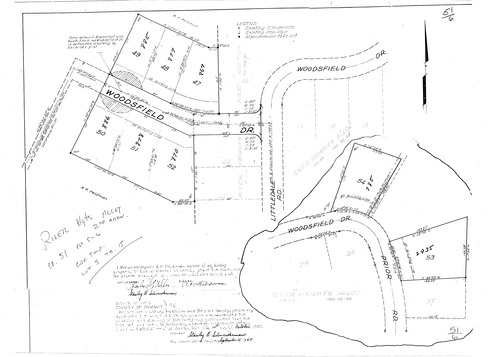
Plat: River Heights Allotment 2nd Addition
Download Original
Identity of Document
Id:
876
Subdivision name:
River Heights Allotment 2nd Addition
Document type:
Plat
Latitude:
41.0210313266165
Longitude:
-81.5529727935791
Dated on:
1957-10-09 00:00:00 -0400
Plat recorded in:
Book 51, pgs. 5 - 6
Drawing Location:
Created at:
2009-06-04 14:28:51 -0400
Created by:
liz
 Download Original