Toggle navigation
Survey Subdivision Home
Viewers
Survey Subdivision GeoSearch
Survey Subdivision Text Search
Supporting data
Zip File Processing
Documentation
Survey Subdivision Tutorial
APIs
Survey Subdivision API
Search
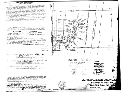
Plat: Pamdon Heights Allotment
Download Original
Identity of Document
Id:
783
Subdivision name:
Pamdon Heights Allotment
Document type:
Plat
Latitude:
41.0334148560176
Longitude:
-81.6659474372864
Dated on:
1965-01-11 19:00:00 -0500
Plat recorded in:
Book 66, pg. 11
Drawing Location:
Created at:
2009-06-02 14:02:13 -0400
Created by:
liz
 Download Original