Toggle navigation
Survey Subdivision Home
Viewers
Survey Subdivision GeoSearch
Survey Subdivision Text Search
Supporting data
Zip File Processing
Documentation
Survey Subdivision Tutorial
APIs
Survey Subdivision API
Search
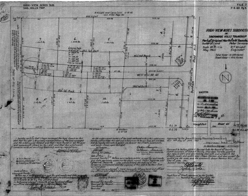
Plat: High-View Acres Subdivision
Download Original
Identity of Document
Id:
496
Subdivision name:
High-View Acres Subdivision
Document type:
Plat
Latitude:
41.344791146555
Longitude:
-81.5625858306885
Dated on:
1961-06-14 20:00:00 -0400
Plat recorded in:
Drawing Location:
Created at:
2009-03-06 15:19:44 -0500
Created by:
jbell
 Download Original