Toggle navigation
Survey Subdivision Home
Viewers
Survey Subdivision GeoSearch
Survey Subdivision Text Search
Supporting data
Zip File Processing
Documentation
Survey Subdivision Tutorial
APIs
Survey Subdivision API
Search
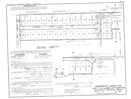
Plat: High Point Acres No.2
Download Original
Identity of Document
Id:
495
Subdivision name:
High Point Acres No.2
Document type:
Plat
Latitude:
41.0618153290961
Longitude:
-81.6835641860962
Dated on:
1964-02-16 19:00:00 -0500
Plat recorded in:
Drawing Location:
Created at:
2009-03-06 15:14:32 -0500
Created by:
jbell
 Download Original