Toggle navigation
Survey Subdivision Home
Viewers
Survey Subdivision GeoSearch
Survey Subdivision Text Search
Supporting data
Zip File Processing
Documentation
Survey Subdivision Tutorial
APIs
Survey Subdivision API
Search
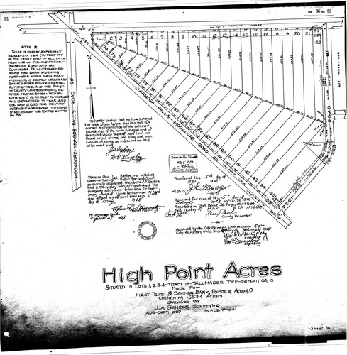
Plat: High point acres
Download Original
Identity of Document
Id:
494
Subdivision name:
High point acres
Document type:
Plat
Latitude:
41.081906717982
Longitude:
-81.4155149459839
Dated on:
1928-05-04 20:00:00 -0400
Plat recorded in:
Drawing Location:
Created at:
2009-03-06 15:10:47 -0500
Created by:
jbell
 Download Original