Toggle navigation
Survey Subdivision Home
Viewers
Survey Subdivision GeoSearch
Survey Subdivision Text Search
Supporting data
Zip File Processing
Documentation
Survey Subdivision Tutorial
APIs
Survey Subdivision API
Search
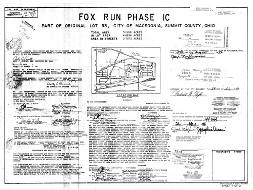
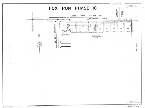
Plat: Fox Run Phase 1C
Download Original
Download Original
Identity of Document
Id:
338
Subdivision name:
Fox Run Phase 1C
Document type:
Plat
Latitude:
41.3354470803335
Longitude:
-81.5297985076904
Dated on:
1992-08-05 20:00:00 -0400
Plat recorded in:
Cabinet L, slides 678 - 679
Drawing Location:
Created at:
2009-06-30 07:48:52 -0400
Created by:
zack
 Download Original
 Download Original