Toggle navigation
Survey Subdivision Home
Viewers
Survey Subdivision GeoSearch
Survey Subdivision Text Search
Supporting data
Zip File Processing
Documentation
Survey Subdivision Tutorial
APIs
Survey Subdivision API
Search
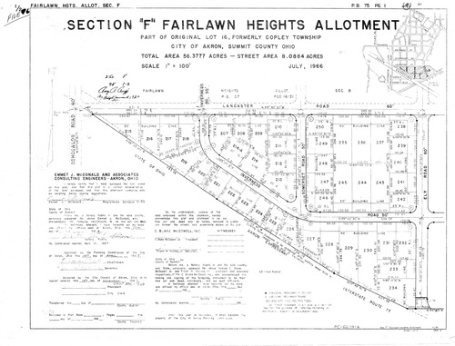
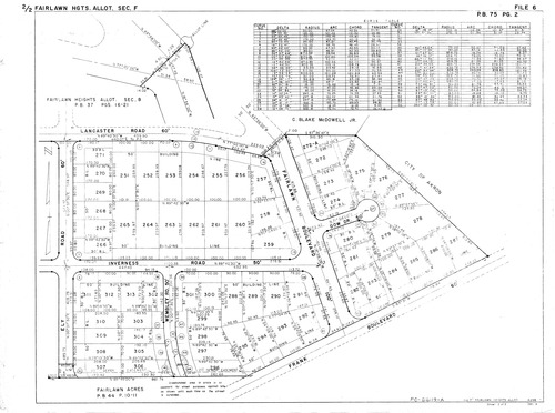
Plat: Fairlawn Heights Allotment Section F
Download Original
Download Original
Identity of Document
Id:
295
Subdivision name:
Fairlawn Heights Allotment Section F
Document type:
Plat
Latitude:
41.1097689037682
Longitude:
-81.6002869606018
Dated on:
1966-06-30 20:00:00 -0400
Plat recorded in:
Book 75, pgs. 1 - 2
Drawing Location:
Created at:
2009-06-25 15:34:45 -0400
Created by:
zack
 Download Original
 Download Original