Toggle navigation
Survey Subdivision Home
Viewers
Survey Subdivision GeoSearch
Survey Subdivision Text Search
Supporting data
Zip File Processing
Documentation
Survey Subdivision Tutorial
APIs
Survey Subdivision API
Search
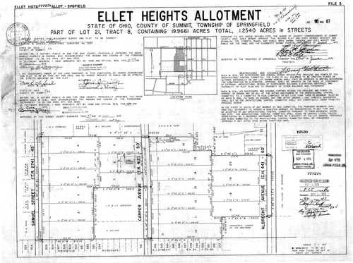
Plat: Ellet Heights Allotment
Download Original
Identity of Document
Id:
271
Subdivision name:
Ellet Heights Allotment
Document type:
Plat
Latitude:
41.0400022682848
Longitude:
-81.4068031311035
Dated on:
1975-09-03 20:00:00 -0400
Plat recorded in:
Book 96, pg. 47
Drawing Location:
Created at:
2009-06-25 15:21:51 -0400
Created by:
zack
 Download Original