Toggle navigation
Survey Subdivision Home
Viewers
Survey Subdivision GeoSearch
Survey Subdivision Text Search
Supporting data
Zip File Processing
Documentation
Survey Subdivision Tutorial
APIs
Survey Subdivision API
Search
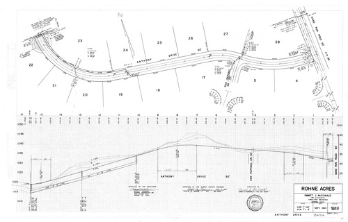
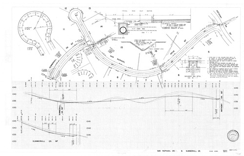
Improvement Plan: Rohne Acres
Download Original
Download Original
Identity of Document
Id:
1508
Subdivision name:
Rohne Acres
Document type:
Improvement Plan
Latitude:
41.1529052761126
Longitude:
-81.5894937515259
Dated on:
1965-05-09 00:00:00 -0400
Plat recorded in:
Drawing Location:
D 120
Created at:
2009-06-05 08:45:09 -0400
Created by:
liz
 Download Original
 Download Original