Toggle navigation
Survey Subdivision Home
Viewers
Survey Subdivision GeoSearch
Survey Subdivision Text Search
Supporting data
Zip File Processing
Documentation
Survey Subdivision Tutorial
APIs
Survey Subdivision API
Search
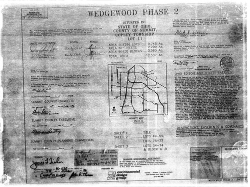
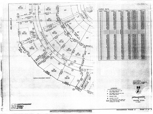
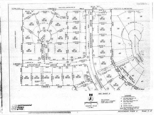
Plat: Wedgewood Phase 2
Download Original
Download Original
Download Original
Identity of Document
Id:
1106
Subdivision name:
Wedgewood Phase 2
Download All Pages
Document type:
Plat
Latitude:
41.124107742455
Longitude:
-81.672191619873
Dated on:
1996-10-06 20:00:00 -0400
Plat recorded in:
Cabinet M, slides 881 - 883
Drawing Location:
Created at:
2009-06-23 13:46:48 -0400
Created by:
zack
 Download Original
 Download Original
 Download Original