Toggle navigation
Survey Subdivision Home
Viewers
Survey Subdivision GeoSearch
Survey Subdivision Text Search
Supporting data
Zip File Processing
Documentation
Survey Subdivision Tutorial
APIs
Survey Subdivision API
Search
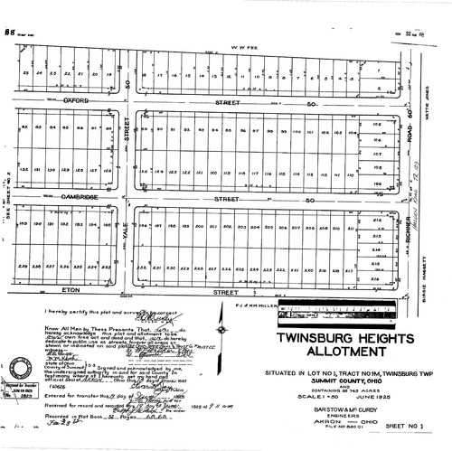
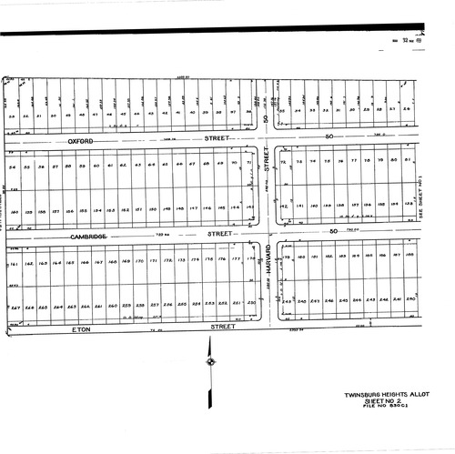
Plat: Twinsburg Heights Allotment
Download Original
Download Original
Identity of Document
Id:
1069
Subdivision name:
Twinsburg Heights Allotment
Document type:
Plat
Latitude:
41.3069232799253
Longitude:
-81.4584732055664
Dated on:
1925-06-18 20:00:00 -0400
Plat recorded in:
Book 32, pg. 68
Drawing Location:
Created at:
2009-06-24 07:51:01 -0400
Created by:
zack
 Download Original
 Download Original